
Bangalore Metro Map
Bangalore Metro Map
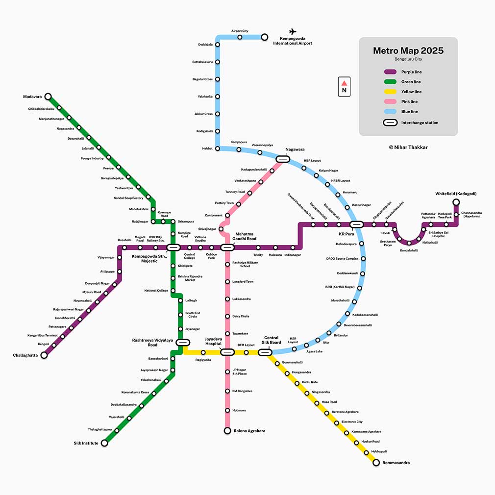
1. Purple Line – Operational
Challaghatta ↔️ Whitefield (Kadugodi)
- 37 stations, East-West spine via Mysore Road, Majestic, MG Road, Indiranagar, KR Puram
2. Green Line – Operational
Madavara (BIEC) ↔️ Silk Institute
- North-South line via Peenya, Yeshwanthpur, Majestic, Banashankari, Kanakapura Road
3. Yellow Line – Operational since Aug 10, 2025
RV Road ↔️ Bommasandra
- 19.15 km fully elevated, connects Jayadeva Hospital, BTM Layout, Electronic City
Under Construction – opening phased in 2026
4. Pink Line
Kalena Agrahara (Gottigere) ↔️ Nagawara – 21.386 km, 18 stations (12 underground)
Status: Elevated section Kalena Agrahara – Tavarekere expected July 2026, full line to Nagawara by Dec 2026
5. Blue Line
Central Silk Board ↔️ KR Puram (18.2 km) + KR Puram – Hebbal – KIAL Airport (37 km)
Airport link via Hebbal, Nagawara. Phase opening expected Sep-Dec 2026.
With 73.81 km already operational before Yellow Line, plus these 3 lines under construction, total network will be 222.2 km once Orange Line (44.5 km) is added.
Interchanges to remember:
- Majestic / Nadaprabhu Kempegowda – Purple + Green
- MG Road & Baiyappanahalli – Purple + upcoming
- RV Road & Jayadeva Hospital – Yellow + Pink + Green